
Hyderabad’s decisions about transport, retail placement, public health, and urban planning are inherently spatial. Data rarely lives in neat tables alone; it arrives as addresses, postcodes, GPS traces, routes, wards, and catchments that need to be analysed on a map. Python’s geospatial ecosystem—centred on GeoPandas—turns these raw coordinates into insights that stakeholders can act on.
This article explains practical techniques for loading, cleaning, projecting, joining, visualising, and scaling geospatial data with an emphasis on Hyderabad’s context. The guidance aims to be tool-agnostic where sensible, while showing how GeoPandas provides a simple path from prototype to trustworthy analysis.
Why Geospatial Analysis Matters in the City
Spatial context sharpens everyday questions. Retailers want to know where footfall is underserved, logistics teams need travel-time reliability across corridors like Outer Ring Road, and civic teams plan ward-level services with limited budgets. Mapping reveals patterns that raw aggregates hide, such as pockets of delay, clusters of missed deliveries, or neighbourhoods with poor access to clinics.
A city-aware approach also improves fairness. By looking at coverage, proximity, and accessibility metrics, teams can identify who benefits from a change and who is left out, then design mitigations before rollout.
Core Concepts: Geometry, CRS, and Topology
Geospatial data represents points, lines, and polygons with rules about how they relate. Points locate events, lines trace routes or rivers, and polygons outline wards, catchments, or store footprints. Valid geometry avoids self-intersections and keeps rings closed, which prevents odd artefacts during overlays and joins.
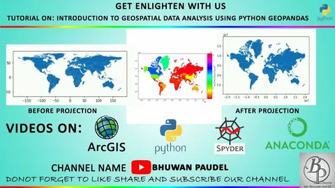
A Coordinate Reference System (CRS) defines how coordinates map to the Earth. You will often read or export in WGS84 (EPSG:4326) for latitude/longitude, then project to a suitable planar CRS for measuring area, distance, or buffering. Working in an appropriate CRS is essential for accurate results.
GeoPandas Essentials
GeoPandas extends pandas with geometry-aware columns and methods. You can read Shapefiles, GeoJSON, and flat files, then compute buffers, centroids, areas, and lengths directly. Spatial joins, overlays, and dissolves operate like familiar pandas merges and group-bys, but they respect geometry and topology.
Under the hood, fast predicates come from libraries such as Shapely and pyproj, while visualisation leans on Matplotlib and contextily for basemaps. This stack keeps prototyping straightforward without hiding important details.
Data Sources for Hyderabad Analyses
Useful layers include ward boundaries, road networks, metro and bus routes, hospital and school locations, market clusters, flood-prone zones around the Musi River, and points of interest. Commercial footfall, delivery telemetry, and customer addresses add private context. Start by documenting provenance, refresh cadence, and restrictions, as spatial projects often blend open and licensed data.
When feasible, use authoritative boundaries that match how your stakeholders speak about the city. Misaligned borders create confusion in meetings and complicate year-on-year comparisons.
Cleaning and Validating Geometry
Real-world boundaries are messy. Use .is_valid to detect broken polygons and .buffer(0) or make_valid patterns to fix them, then simplify cautiously to reduce vertex counts for faster maps. Ensure polygon orientation is consistent and holes are correctly represented, especially when dissolving adjacent regions.
Deduplicate points by snapping close duplicates and normalise addresses before geocoding. Small hygiene tasks early prevent long debugging sessions during spatial joins.
Skills and Learning Pathways
Teams need comfort with projections, joins, and cartographic choices, plus habits for testing and documentation. Analysts should recognise when a buffer is appropriate, when nearest-neighbour logic misleads, and how to communicate uncertainty in boundary cases. For structured, practice-led development that blends fundamentals with exercises and peer review, a Data Analyst Course can provide a pragmatic route into reliable spatial analysis.
Practical learning sticks when paired with live projects—local catchments, route reliability, or ward scorecards—rather than abstract examples. The goal is fluent judgement, not just library recall.
Privacy, Ethics, and Sensitivity
Spatial data often represents people. Apply purpose limitation, minimise personal detail, and aggregate where possible. Keep a suppression policy for small counts near sensitive facilities, and review maps for inference risks before publication.
Transparency about uncertainty and scale prevents over-interpretation. Clear captions and footnotes guide responsible use across departments.
Local Ecosystem and Careers
Hyderabad’s employers value portfolios that show disciplined mapping over decorative screenshots. Repositories with tidy code, CRS notes, and interpretable choropleths stand out in hiring. For place-based mentoring and projects tied to regional sectors—IT corridors, logistics, utilities, and civic services—a Data Analytics Course in Hyderabad connects students to city-specific datasets and review rituals.
Local familiarity matters. Knowing ward boundaries, seasonal festival traffic patterns, and choke points like HITEC City or Charminar turns generic maps into decision-ready tools that managers will trust.
Implementation Roadmap for Teams
Start with a narrow, valuable slice: one outcome metric, one geography, and one time window. Land boundaries, validate geometry, project correctly, and ship a first map that answers a concrete question. Add spatial joins, drill-downs, and simple alerts after the core view earns trust.
Move from notebooks to pipelines by parameterising inputs, pinning package versions, and writing tests for geometry validity and join cardinality. This shift makes analysis dependable under turnover and growth.
Common Pitfalls and How to Avoid Them
Do not measure metre-level distances in degrees; project first. Avoid plotting heavy, high-resolution geometry at small scales; simplify appropriately. Be wary of edge effects when joining points to polygons; a tiny shift in boundaries can change counts near borders.
Another trap is over-confident colouring. If input data are sparse or noisy, prefer wider uncertainty bands, lighter claims, and more aggregation until evidence strengthens.
Upskilling and Community Practice
Communities of practice—brown-bags, map critiques, and code clinics—help teams converge on good defaults for projections, colours, and legends. Shared templates for ward maps, corridor overlays, and facility catchments reduce reinvention and encode lessons from incidents.
For deeper consolidation of patterns—testing, observability, and performance—a second pass through a Data Analytics Course in Hyderabad can help practitioners mentor newcomers and keep standards consistent across squads.
Future Directions to Watch
Expect easier contract-first data exchange, richer GeoParquet support across tools, and tighter links between streams and tiled maps for near-real-time views. Privacy-preserving aggregation will move from policy to practice as teams release more public-facing dashboards.
AI-assisted generalisation and name-matching will reduce grunt work, but human judgement about ethics, context, and cartography will remain decisive for trustworthy maps.
Conclusion
GeoPandas makes spatial thinking practical for Hyderabad’s analysts by pairing familiar pandas workflows with geometry-aware tools. With disciplined CRS handling, sound joins, cautious cartography, and strong provenance, maps become a dependable way to reason about the city. As teams standardise patterns and share playbooks, they turn coordinates into outcomes that serve people and places across Hyderabad. For those seeking guided, locally relevant pathways into this craft, a Data Analytics Course in Hyderabad can bridge the gap between theory and production-ready mapping.
ExcelR – Data Science, Data Analytics and Business Analyst Course Training in Hyderabad
Address: Cyber Towers, PHASE-2, 5th Floor, Quadrant-2, HITEC City, Hyderabad, Telangana 500081
Phone: 096321 56744